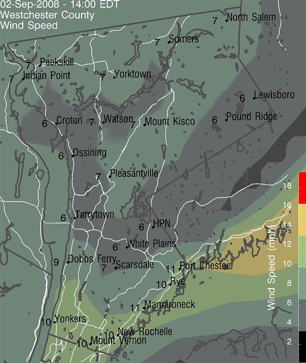
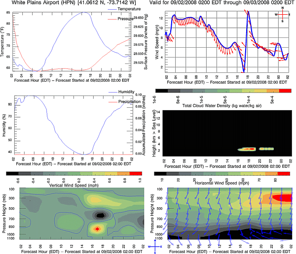
Current Deep Thunder Forecast for Westchester County

Products for County Operations and Emergency Planning

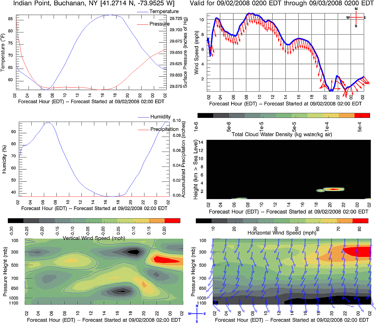
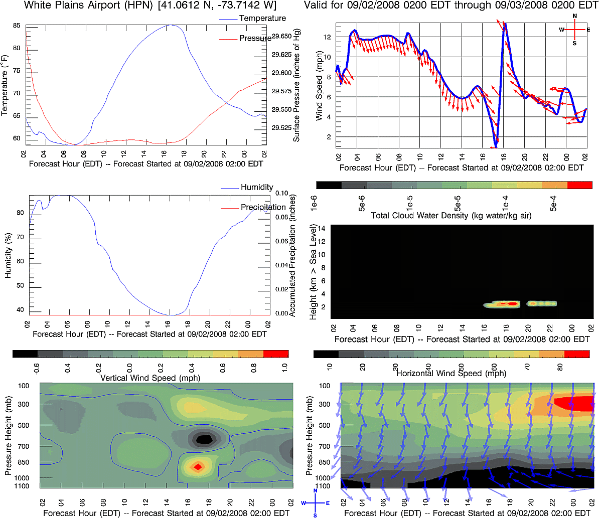
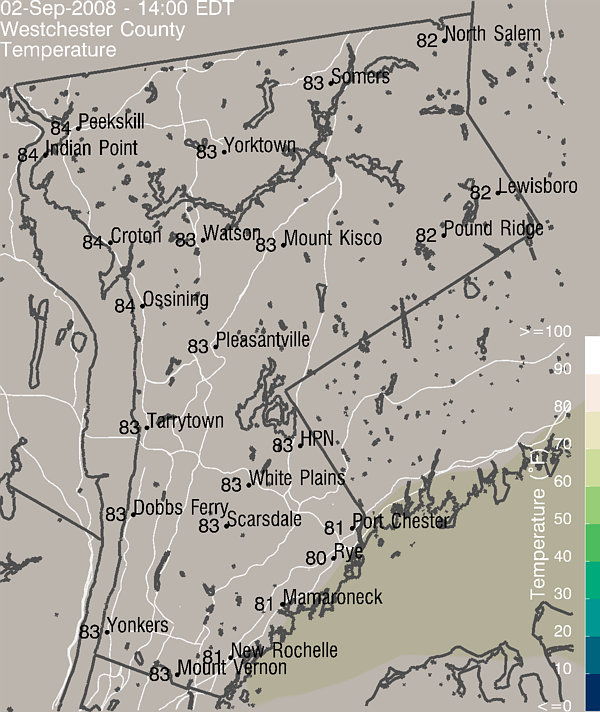
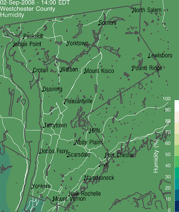
Click on any of the five images below to see and/or interact with
these model forecast products. All of them show forecasted information
in Westchester County. The first focuses on temperature,
the second focuses on precipitation and the third focuses on wind,
while the fourth and fifth illustrate
upper air winds and surface conditions at Indian Point and White Plains
Airport, respectively.

You can learn more about this technology, relevant data
and weather forecasting, at the following sites:
More Visualizations of the
Current Forecast
Learn More about These Forecasts
Recent High-Resolution Local
Satellite Observations
Learn
More about Deep Thunder
Learn
More about how Deep Thunder Visualizes the Data Generated by the
Weather Model
Current Weather
Information and Predictions for New York City (from the National Weather
Service)
Current Model Results from the
National Weather Service
Recent High-Resolution Local Radar Observations
Evaluation of Recent Forecasts

lloydt@watson.ibm.com